At 1:44 p.m., the NWS reported Dayton had a 59 knot — 68 mph — gust.
Thousands were without power around 3:15 p.m. Tuesday. AES Ohio had more than 5,900 customers without service. By about 11 p.m. most of those outages had been resolved, but hundreds remained without electricity into the overnight hours.
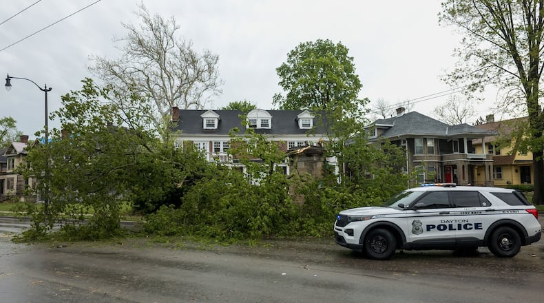
Multiple trees and branches were knocked down in the region. A large pine tree was downed in Brookville and a 12-inch tree limb fell in West Carrollton, according to the NWS. Later reports added trees and wires down on Robert Simmons Drive near Carlisle, and near Springboro.
Dayton police asked motorists to be careful on the roads after receiving multiple reports of trees down in the city, including one near Salem and Yale avenues.
The southbound lanes and one northbound lane of Salem Avenue were closed near Yale Avenue as crews worked to remove the tree.
Woodman Drive was closed near Kroger in Riverside due to a broken pole.
Credit: Sarah Cavender
Credit: Sarah Cavender
Crews responded to downed power lines and trees in Clark County but there was no significant damage, Clark County Sheriff Chris Clark said. There were power lines down on East National Road and North Houston Pike in Springfield and trees and wired down in South Charleston.
Rain and thunderstorm chances will continue through the night.
Drier conditions are expected Wednesday, with partially sunny skies.
Temperatures will be a few degrees cooler, with highs in the low 70s.
Rain and thunderstorm changes return late Wednesday. Multiple rounds of showers are expected through Saturday.
Credit: Nick Graham
Credit: Nick Graham


