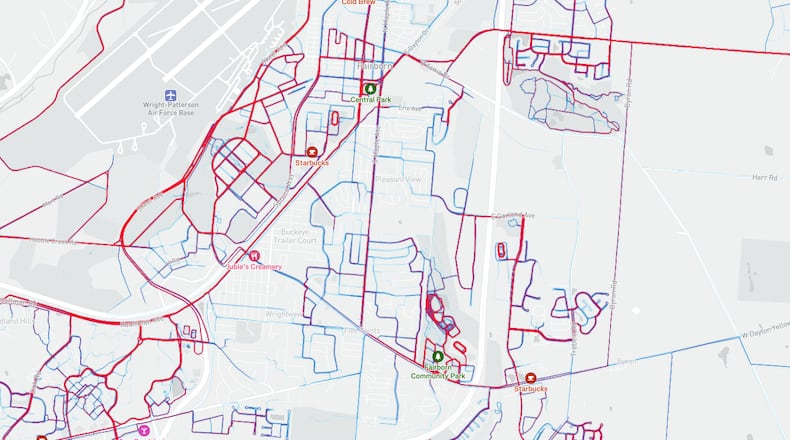
The city’s Active Transportation Plan is designed to expand “safe, accessible and appealing opportunities for both walking and biking in the city,” the plan says.
The plan received input from more than 200 residents. One suggestion from Fairborn residents is to call for installing so-called Dutch intersections, which include protected bike lanes, set-back crosswalks and improved sight lines. The idea is to keep pedestrian and bike traffic separate from vehicle traffic as much as possible.
Additionally, the plan proposes adding facilities for mountain biking, hiking and obstacle courses within the park and trail system. These types of activities have risen in popularity, according to city documents.
“Other cities have done this,” Fairborn Planning Specialist Brad Kerry said to the city council on Monday. “That not only allows their citizens to move throughout the city in a fun way, but it also draws many visitors annually.”
Fairborn does have some existing sidewalks and bike paths, but part of the goal is to connect these with the Buckeye Trail — which loops the entire state — and North Country Trail systems.
“This is what developers are telling us people want,” said city councilman Rodney McCubbins. “It seems to be very important to people ... a lot of it can be done with concurrent projects at minimal costs.”
The main infrastructure projects that would take place as part of this plan include on-street bike lanes, shared-use paths for pedestrians and cyclists and dedicated hiking trails within parks. Trailheads are proposed for Oakes Quarry Park, Community Park, Faircreek Park, Wright State University and a Central Park Hub in downtown Fairborn, which could be used to access regional trail systems.
Other improvements include additional parking for high-traffic areas, installing safer crosswalks, improvements for disability access and others.
The city used publicly available data to determine which routes people are already using to walk and bike to their destinations. Maple Avenue and the Huffman Prairie/ Buckeye Trails are the most heavily traveled multiuse paths in the city, city documents show. These routes would take first priority for any proposed improvements, city plans say.
None of the infrastructure projects listed are currently planned or scheduled, but the projects will be considered as part of future developments, according to the city, in order to keep costs down.
“The plan is designed to continue to expand with new development, so it’s not something where we have to reinvent the wheel each time,” Kerry said.
About the Author

